Monday, 20 June 2016

Thursday 16  rainy day so an easy time ashore at Port Edgar looking around historic South Queens-ferry under the bridges. Pub lunch and a visit to a museum. Lovely place with ancient organic architecture running down to the Forth under the huge bridges


 Friday 17 Port Edgar to Anstruther via Inchcombe Island 30 miles 7 hours.
Early start, good visability calm sea edging the northern shipping lane, easing past some basking seals into a lovely anchorage at Inchcolme island just under shore of ruined abbey. Breakfast with dramatic views across to Edinburgh.

Then a wonderful long sail all the way along the Fife coast past the numerous harbours, villages to Anstruther. Mooring against the wall, this time drying out.
Beautiful small town in 2 parts ancient and more recent harbour. Fish supper at the famous award winning fish restaurant.


Saturday 18 Anstruther to Isle of May to Inner Farne; 54 miles 11 hours, an endurance day
Late start, till afloat again. Short journey on a brief northerly to the Isle of May, a good place for a longer visit another time. Wind rapidly turned to southerly just off the nose, predicted stronger for the following day. Conscious decision to try to get back to the Farnes so as to make Sunday’s sail shorter. Sea big rolling in from the northeast. A long tiring day with deteriorating weather. Difficult making passage. Farnes most welcome tricky identifying safe buoyage because of the sea conditions. The Kettle mooring a refuge from moving all the time. Wonderful light and vistas. By 4 am tide full and the calm of our moorings a seething cauldron with a strong westerly and flying foam, moorings secure allowing a fitful sleep.

Sunday 19 Farnes to Blyth 32 miles, 8 and half hours.
Sea and gathering wind on the nose making for slow and painful passage, motor sailing and lots of tacking as without sail power speed down to 2 knots.
Slowly steadily ground covered, quickest closer in shore.
Home to Blyth eventually


Wednesday, 15 June 2016

Monday 13 June
Next trip, Alan Conn and I heading North. Day dawns misty, unfavourable, shall we sail?
Quietly slip past north east pier end, light house in the mist then head east then north, little wind so motor sailing in the contracted slightly confusing misty world, land out of sight.
Some hours later the mist starts to lift and 2 miles off shore we see Amble and north Northumberland, Craster and Dustanburgh pass. 6 hours into the journey we approach the Inner Farne. Birds every where arctic terns, guillemot, razor bills and lots of puffins, seals as we enter the shelter of the “kettle”
My favourite place, 4 castles in view, 360 degree panorama, smell of guana, bird sounds, inquisitive seals, distant warning lights Longstone light house.
Swallow creaks and sways on her mooring, it couldn’t be better.


Tuesday 14 Farnes to Dunbar 43 miles 10 hours.
A day for long distance sailors. Set off with modest visibility, against the tide towards Holy island, as we past, fog mist and rain descended and persisted. Fishing boat looming out of the mist. A day you knew you would enjoy more in retrospect.
Brief relief as we past St Abs head shrouded in mist and on to Dunbar a little early to enter so some circles in the bay waiting for the tide. Mooring against the harbour wall under the Kittywakes.

Wednesday 15 Dunbar to Port Edgar 36 miles 8 hours
Another wet, wild and atmospheric day punctuated by a close look at the Bass Rock and mooring for lunch at North Berwick.
Then mist and rain steering between islands on the chart plotter to arrive at the fairway buoy and enter the northern Forth shipping channel, with its significant shipping load, full of big ships
North Easterly brisk wind running sail ending under great bridges.
Shelter on a pontoon at Port Edgar


Friday, 27 May 2016

Friday 27, this is unbelievable

We had resolved to return in the face of the threatened northerlies.
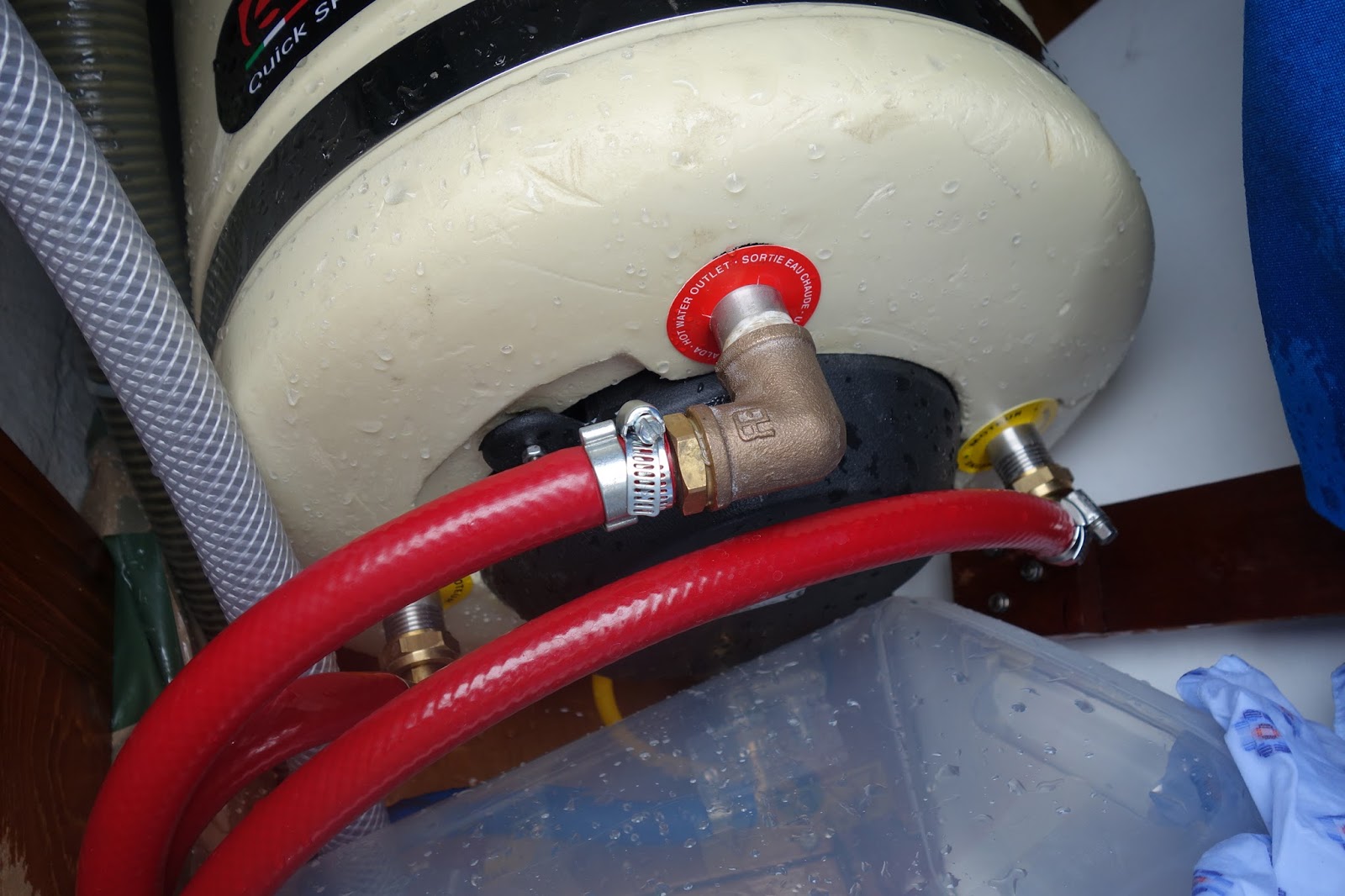
Set off with plenty of water in a northern tidal stream, no wind, so motor sailing under leaden skies.  A few hours into the 6-hour journey with Ray the auto-helm steering, I started some locker cover maintenance; completed the starboard lid and opened the port side. To my horror a stream of water was pumping out of the topmost connection to my new hot water tank, the crimp clip had slipped with the heat of the continually running engine. The boat was flooding.
Thankfully we were able to turn the water off and urgently pump all the water out of the bilge, without damage to the boat.
The pic shows the reattached hose with a jubilee clip.
Lovely rest of journey.
That's enough drama for one trip


Thursday, 26 May 2016

An ill-fated voyage, Thursday 26
Wind easing and sea state calmer so we decided for Whitby. Short weather window as strong Northerlies forecast for the weekend which would make a return to Blyth difficult/impossible
Advised by marina 11.30 departure latest safe leaving time, thereafter channel too shallow for our draft.
As we locked out it was clear not enough water and very soon we were aground and stuck with an hour and a half of falling tide. Not a familiar predicament, no help from marina or advice from local coast guard, apart from checking we were safe.
2 anchors, aft and stern, all drinking water, three quarter of a ton jettisoned and waited with some trepidation, would we tip over?
Thankfully with about a metre of water we rocked the keel into the sand and remained afloat and upright, WHEW!!!!  Back in when enough water.

Is someone trying to tell us something?  Home tomorrow to sail another day.

Image are of us aground from the chart plotter and back in the lock.
Wednesday 25
Ventilation cover arrived and installed, 5 days following the incident.
We felt desperate to sail somewhere, wind F6 NNE sea state rough (3 meter waves), only one direction possible; south, running mostly some broad reach. We had learnt from our misadventure, so hoisted the foresail only and taken by the motion of the sea slewing as the waves passed under us sometimes even surfing the 5-ton yacht down the waves averaging 6 knots to Hartlepool. That slightly unnerving feeling looking back, seeing an approaching wave towering over the back of the boat. Thankfully she rides over.  In the distance waves on the breakwaters 30ft white water plumes.
Very welcome coming in from what had become a rather confused sea with persistent rain (north sea summer sailing)
On a pontoon now, heaters going drying the oilskins, Mexican chicken from Carolyn, Mark Knopfler . on the CD , well sleep well.

 Possibly Whitby tomorrow.

Saturday, 21 May 2016

Saturday 21, Limping back

Departed at last from from Blyth this morning, wind SSE 18-24 knots.
Running before with full foresail and mainsail at times doing 7+knots.

Always a tricky point of sail, minor course changes easily destabilize sail balance.
I had poled out the foresail to stabilize it, with a spinnaker pole attached to the mast at one end and the sail ring at the other.

Unfortunately the heading was momentarily lost and the mainsail gibed badly from full starboard to full port. The foresail similarly backed with great force wrenching the spinnaker pole from the mast and the flailing pole swept one of the ventilation covers off the coach roof .
The cabin was now open to the sea, no way to start a long voyage.

So back to port for repairs and renewals, could have been much worse
Better sail another day

Pic shows repair of coach roof to keep weather out

Thursday, 19 May 2016

A new adventure

Thursday 19 May 2016. A long time since I visited this blog.
Mick and I hope to set sail again on Saturday for Oban, retracing the first part of the circumnavigation journey of 2 years ago.
Swallow has had a refit (including hot water which is leaking, hopefully to be repaired tomorrow)
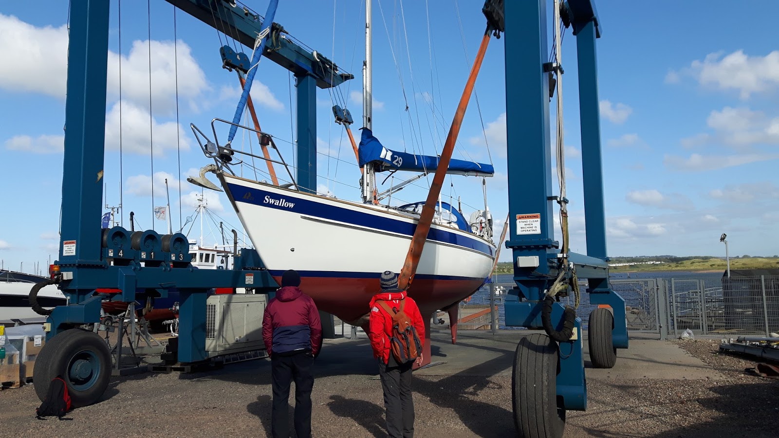
She was launched last Saturday from Amble just after this pic was taken and is now in Blyth.
I'll maintain the blog so as to communicate with those interested in following our progress


Sunday, 29 June 2014

Last leg and home

Day 25 in fact day 26 Arbroath to Eyemouth

Early morning purchase of famed "Arbroath Smokies" hot smoked haddock and "smokie fish cakes"
Only enough water to exit harbour at 12.30 so visited lighthouse museum celebrating Bell Rock lighthouse construction between 1807-1811, extraordinary feat on a tidal reef in the Forth of Firth only exposed at low water. Special locking stones designed and used.

Exiting into strongest wind so far, force 5 gusting 6,first reef in and only half foresail out, scooting along in moderate to rough sea. We had decided to sail due south via Isle of May rather than a direct route taking us deeper into the Firth before turning east to round St Abbs 
Head. Second reef necessary.  A long day out in heavy sea tossed about yet always safe in trusty Swallow.

Somewhat scary approach to Eyemouth in an west flowing sea with waves making the approach in the crowded bay difficult because of the extent of agitation. Once in through the canyon all calm, safe and a sense of deep relief. Resident seals begging.
Let's hope an easier day tomorrow our last day aboard.

The last day Saturday 28 June

Interesting dredging activity in Eyemouth harbour making for some good pics

Through the canyon one last time, with some trepidation on a "strong winds are expected later" warning. We are all keen now to reach home and being in familiar waters feel able to face some more uncomfortable seas.

As it transpired strong winds blew for 30 minutes allowing a comfortable journey via Inner Farnes on the tide, with wonderful views of Holy Island, the unfolding of Northumberland and it's famed castles Bamburgh and Dunstanburgh, Coquet lighthouse to Blyth and Swallow's usual berth.

The end of an extraordinary journey.  

Total journey = 867.52nm (Lands End to John O'Groats is only 603 miles)
Total miles by crew 1 = 389.18nm
Total miles by crew 2 = 478.34nm
 
Total hours at sea = 194hrs
Total hours at sea by crew 1 = 91hrs 40mins
Total hours at sea by crew 2 = 102hrs 20mins
 

Wonderful places visited, great bonhomie without exception. 
3 cooped up in a small space, facing considerable physical hardship at times testing us close to our limits of endurance. A real sense of accomplishment.

Made possible by:

mutual cooperation and respect.

An unusual weather window which allowed sailing every day we chose

Lastly the amazing technology that is available today, modern chart plotter allowing  accurate navigation even in heavy mist. 
As well on the IPad, continuous updating of our position in great detail, measurement of distance travelled and to be travelled, dynamic tidal stream maps allowing hour by hour examination of likely stream patterns and access to a variety of weather reports.

Thanks to our patient spouses Linda, Lesley, Jenny, Carolyn and Gay

Thank you too all who have shared our journey.

And finally, trusty safe Swallow 

Thursday, 26 June 2014

An easy day at last

Day  24 
L

Fitful sleep tied up against the harbour wall, a strange balance of long warps that allow tidal movements of more than 4 meters. 
Lovely dinner of very fresh fish and chips.

Early start to ensure timed entry to Arbroath. 
Another day hugging the coastline, more castles, fishing villages, guano stained cliffs, wheeling teaming birds. Bob Dylan and Sugarman
Steering around the frightening multitude of lobster pots to Arbroath (where we snagged a lobster pot last year)
Place to buy the famed "smokies" 

Wednesday, 25 June 2014

2 further days, the Moray Firth and Stonehaven again


Day 22 Crossing the Moray Firth, a long days night

Previously I have crossed the Firth (the largest stretch of open UK water) in 2 separate day's sailing, traveling south first to Whitehills then east to Peterhead negotiating Rattray Head a dangerous headland with shallow reefs causing turbulence in the strong tidal stream  particularly when the tide is against the winds. By plotting a course from Wick to Peterhead, southeast one can save 20 miles and approach Peterhead with enough offing not to be exposed to the turbulence of Rattray Head.

We agreed this strategy knowing this would be a strenuous test of endurance. Predicted weather conditions were good with excellent visibility and a force 3 to 4 north east wind, sea state slight to moderate. We had to time our arrival at Rattray Head so as not to arrive before 9,30 pm.

And so it was, a long day in the sea and wind; watching the cliffs of Wick slowly diminish hour upon hour, visible for 30 miles, the huge Highland peaks behind them seemingly never fading, still discernible at 50 miles as the headland ahead agonisingly changed from a smudge to a growing land mass. In such a space with visibility for near on 70 miles ones progress is snail like and painful, seemingly not to change by the minute and barely by the hour.

A journey of 82 miles taking 141/2 hours requires a special endurance, so arriving at 0145 we were elated, cold and exhausted, delayed briefly for a supply ship to enter the harbour ahead of us

Day 23

After a dead like sleep and hot shower, revived we exited the bustling port filled with strange gigantic craft servicing the off shore oil and gas industry. Turning south now hugging the rugged coastline of Aberdeenshire and Angus, easy navigation minding the many lobster pots watching the slowly changing sequence of villages, ruined castles, small harbours and cliffs with speeding east coast rail and road above the mirror like sea.

So to Stonehaven again that delightful harbour and town
Inching our way home.


Monday, 23 June 2014

Day 21 turning for home and the Pentland Firth

For the first time in 3 weeks we have pointed the bow south wards.
From Stromness taking the route through the many islands that make up Scapa Flow.

This is the site of many sea battles, with many wrecks and fortification.
During the First World War the German navy scuppered their fleet in Scapa Flow.
In the Second World War Churchill sunk old ships to block off the small channels into this landlocked sea to prevent U-boats taking a short cut to the North Atlantic 

The Orkneys are separated from mainland Scotland by the Pentland Firth, a notoriously dangerous stretch of water where the tidal stream can reach 9 knots at springs. The sailing directions all .provide very cautious advice with regard to crossing this  8 mile stretch of water, where over falls, whirlpools and races can cause difficulty especially in high seas and adverse winds.

We prepared in great detail for the day consulting with other sailors and harbour masters. Our passage was timed perfectly and effortless, then with the stream behind us we sped towards Wick at times at more than 8 knots 

Sunday, 22 June 2014

A spiritual day


Day 20 

On the bus again, now to the Neolithic centre of the Orkneys;  
Maeshowe, Ring of Brodgar and the Standing Stones of Steness. 

The words evoke the misty past of one of the most extraordinary, evocative and without doubt spiritual place I have ever experienced.

Set in a massive basin, ringed by hills on all sides, the Neolithic people whose homes we visited yesterday, motivated by a spiritual vision, constructed with stone tools, before even the Bronze Age a massive series of complex meticulously engineered burial mounds and stone circles that stand today.
No signs of slave labour or of oppression, rather a spirit of cooperation and celebration straddling many years; truly civilised behaviour. Without the wheel they transported and erected huge slabs of stone reflecting the geological character of the many parts of these islands. 
Such was their skill that they were able to orientate the entrance of Maeshowe to allow the winter solstice sun to be focused on the principal bridal chamber.

Truly moved, I am in awe.

So too have been successive peoples, bronze age burial mounds constructed 500 years later than the original Neolithic structures surround the Ring of Brodgar, Crusaders and Norseman have carved cryptic runes on the stone faces inside Maeshowe.

This is a wonder worth struggling to find

Saturday, 21 June 2014

Exploring Orkney

Day 19

Slow recovering day yesterday, washing drying and cleaning Swallow
Looking around Stromness, a working port with the old Center still largely intact 
Narrow steep streets leading directly onto the sea with many houses having their own slipways

Then today exploring the ledgendry antiquities set in an amazing landscape 

Skara Brae uncovered in a storm in 1850, the best preserved Neolithic settlement in Europe; more than 5000 years old; before the pyramids were built sophisticated master craftsman were living and working these fertile shores.

Brough of Birsay, Pictish and Norse homestead occupied between 600 AD and 1200.

These were the motivation for the visit and have rewarded the effort of getting here

Friday, 20 June 2014

Onwards


Day16  mists and the Minch

Dingy packed away and out of Badachro bay, misty with poor visibility again, a whisper of wind so another day of motoring.

A moment of sunshine as we drew level with Rubha Reidh lighthouse , lovely views across the northern point of Skye to Uist and South Harris which was 30 miles away.

Then more fog obscuring the famed Summer Isles, forcing us to safer water further west 

Some clearing in the afternoon as we approached Kinlochbervie, now be beginning to feel the Atlantic swell sweeping past the northern point of Harris. Beginning to feel like the end of the world. Enough visibility to approach through the Whale islands into a narrow desolate but safe passage to this tiny remote harbour. 

Just a hint of the massive that is Cape Wrath on our bow as we turned in

Minimal facilities no mobile phone reception, no FM reception, a desolate feel to this tiny fishing community. The only bread was frozen. No WiFi

Some discussions with the community of waiting sailors regarding our intended plans with good advice from a visiting lone Shetland yachtsman. Transient gale warning on Orkney.

Day 17  The North Atlantic, rounding Cape Wrath and Stromness bay

We slept fitfully, the magnitude of our undertaking on everyone's mind;
2 major tidal gates, rounding the feared Cape and entering an unseen harbour at night with a tidal stream of 8 knots, 75 miles of gruelling exposure.

The early weather report was more favourable, our calculations checked and rechecked, our route discussed, our resolve firm and agreed.

Coming out of Kinlochbervie bay we knew we would face wind over tide so as to bring us to Cape Wrath in time for the east flowing stream. We entered a confused agitated sea off the point but could see beyond to calmer waters.

Then with wind on the beam and with the recommended 5 mile offing we approached the legendary cliffs, watching their dreadful grandeur. As before with appropriate preparation and perfect timing there was no threat, only wonder as the whole of the Northern Scottish coastline opened to our starboard, visible for 30 to 40 miles. The stream lifted our boat speed so that at times we were doing 7.5 knots over the ground

On and on as Cape Wrath gradually faded into the distance, big Atlantic rollers on the beam, Swallow happy even though we remained apprehensive as gradually in the early evening Hoy and Stromness cliffs began to emerge from the eastern cloud and we inched closer timing our approach for 11.27, slack water and the in going west flowing tide which would allow us out of what had by then developed into a rough sea.
Through the gloom steered by our chart plotter and the winking leading lights we approached the haven of calm water and less wind. Safe we collapsed into an exhausted and deeply satisfied sleep

We had sailed for 151/2 hours covering 74 miles to arrive at the best Neolithic site in Western Europe 

Tuesday, 17 June 2014

Onwards

Day 15 Southern Minch

Lovely walk around Plockton first thing to visit old haunts, a unique space around Loch Caron
Then off again up along the Inner Sound, the islands of Scalpay, Raasay and Rona  lying between us and Skye, and as we progressed distant views past Skye of to the outer Hebredes and South Uist. 

Where ever one looked a magical panorama for tens of miles, remote places, dominated by towering misty mountains.
On to Lock Gairlock and the famous mooring in the sheltered bay of Badachro.
Dingy to the slip to pay our dues.
Supper of red Thai curry as the fog deepened 


Day16  mists and the Minch

Dingy packed away and out of Badachro bay, misty with poor visibility again, a whisper of wind so another day of motoring.

A moment of sunshine as we drew level with Rubha Reidh lighthouse , lovely views across the northern point of Skye to Uist and South Harris which was 30 miles away. At times I feel I'm looking at the end of the earth

Then more fog obscuring the famed Summer Isles and forcing us to safer water further west.

Now in Loch Inver, remote beautiful bay guarded by small islands and narrow channels, and beyond Stornaway and the end of the Hebredian chain. The open Atlantic beckons, if the high holds we will try to round Cape Wrath and get to the Orkneys.